AI Agent for Agriculture: Automate Crop Monitoring, Yield Prediction & Supply Chain (2026)
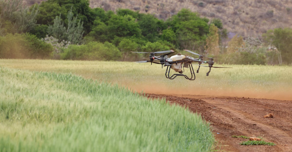
Photo by Magda Ehlers on Pexels
Agriculture produces $3.5 trillion in global value annually, but most farms still rely on manual observation, gut-feel decisions, and reactive pest management. AI agents are changing this — autonomous systems that monitor crops 24/7, predict yields with satellite data, detect diseases before they spread, and optimize every input from water to fertilizer.
This guide covers six production-ready AI agent workflows for agriculture, with architecture details, code examples, and real ROI numbers.
What You'll Learn
1. Automated Crop Health Monitoring
Traditional crop monitoring means walking fields — slow, inconsistent, and limited to what the human eye catches. An AI agent combines satellite imagery (Sentinel-2, Planet Labs), drone footage, and IoT sensor data to monitor every acre continuously.
How It Works
- Data ingestion — Pull multispectral imagery on a regular schedule (Sentinel-2 every 5 days, drones weekly)
- NDVI computation — Calculate Normalized Difference Vegetation Index to assess plant health
- Anomaly detection — Flag zones where vegetation health drops below field-specific thresholds
- Alert generation — Send geo-tagged alerts with severity classification and recommended action
import numpy as np
from datetime import datetime

class CropMonitorAgent:
    def __init__(self, satellite_client, sensor_client, alert_service):
        self.satellite = satellite_client
        self.sensors = sensor_client
        self.alerts = alert_service
        self.ndvi_history = {}

    def compute_ndvi(self, red_band, nir_band):
        """NDVI = (NIR - Red) / (NIR + Red), range -1 to 1"""
        ndvi = (nir_band - red_band) / (nir_band + red_band + 1e-8)
        return np.clip(ndvi, -1, 1)

    async def monitor_field(self, field_id, bounds):
        # Pull latest satellite imagery
        imagery = await self.satellite.get_latest(
            bounds=bounds,
            bands=["red", "nir", "swir"]
        )

        ndvi = self.compute_ndvi(imagery["red"], imagery["nir"])
        field_mean = float(np.mean(ndvi))

        # Compare against historical baseline
        history = self.ndvi_history.get(field_id, [])
        if len(history) >= 4:
            baseline = np.mean([h["mean"] for h in history[-4:]])
            drop = baseline - field_mean

            if drop > 0.15:
                # Significant health decline — identify affected zones
                stress_mask = ndvi < (baseline - 0.1)
                stress_area = float(np.sum(stress_mask)) / ndvi.size * 100

                await self.alerts.send(
                    field_id=field_id,
                    severity="high" if drop > 0.25 else "medium",
                    message=f"NDVI dropped {drop:.2f} from baseline. "
                            f"{stress_area:.1f}% of field affected.",
                    zones=self._extract_zones(stress_mask, bounds),
                    recommended_action=self._recommend_action(drop, imagery)
                )

        # Store for trend analysis
        history.append({"date": datetime.now(), "mean": field_mean})
        self.ndvi_history[field_id] = history[-20:]

    def _recommend_action(self, ndvi_drop, imagery):
        swir_mean = np.mean(imagery["swir"])
        if swir_mean > 0.3:
            return "Water stress detected. Check irrigation system."
        elif ndvi_drop > 0.25:
            return "Severe decline. Scout field for disease/pest damage."
return "Monitor closely. Schedule drone flyover for detail."Data Sources for Crop Monitoring
| Source | Resolution | Frequency | Cost |
|---|---|---|---|
| Sentinel-2 | 10m/pixel | Every 5 days | Free |
| Planet Labs | 3m/pixel | Daily | $1-5/km²/month |
| DJI Matrice drone | 1-5cm/pixel | On-demand | $15-30/acre/flight |
| IoT soil sensors | Point data | Real-time | $50-200/sensor/year |
2. Yield Prediction & Forecasting
Accurate yield prediction lets farmers optimize harvest logistics, negotiate better contracts, and plan storage. An AI agent fuses weather data, satellite imagery, soil conditions, and historical yields to forecast production 2-6 months ahead.
Architecture
The yield prediction pipeline uses an ensemble approach:
- Feature engineering — Growing degree days (GDD), cumulative precipitation, NDVI trajectory, soil moisture history
- Model ensemble — XGBoost for tabular features + CNN for imagery + LSTM for temporal sequences
- Calibration — Isotonic regression on holdout data to convert raw predictions to calibrated probabilities
- Explanation — SHAP values to explain which factors drive the prediction up or down
class YieldPredictionAgent:
    def __init__(self, weather_api, satellite_client, soil_db):
        self.weather = weather_api
        self.satellite = satellite_client
        self.soil = soil_db
        self.models = self._load_ensemble()

    async def predict_yield(self, field_id, crop_type, planting_date):
        # Gather all input features
        features = await self._build_features(field_id, crop_type, planting_date)

        # Run ensemble prediction
        predictions = {}
        for name, model in self.models.items():
            pred = model.predict(features[name])
            predictions[name] = pred

        # Weighted ensemble (weights from validation performance)
        weights = {"xgboost": 0.45, "cnn": 0.30, "lstm": 0.25}
        final_yield = sum(
            predictions[m] * weights[m] for m in weights
        )

        # Confidence interval via quantile regression
        lower = self.models["xgboost_q10"].predict(features["xgboost"])
        upper = self.models["xgboost_q90"].predict(features["xgboost"])

        return {
            "predicted_yield_tons_per_hectare": round(final_yield, 2),
            "confidence_interval": [round(lower, 2), round(upper, 2)],
            "confidence_level": 0.80,
            "top_factors": self._explain(features, predictions),
            "forecast_horizon_days": self._days_to_harvest(crop_type, planting_date)
        }

    async def _build_features(self, field_id, crop_type, planting_date):
        weather = await self.weather.get_historical_and_forecast(
            field_id=field_id, days_back=120, days_forward=60
        )
        gdd = self._compute_gdd(weather, crop_type)
        precip = self._cumulative_precipitation(weather)

        ndvi_series = await self.satellite.get_ndvi_timeseries(
            field_id=field_id, days_back=120
        )

        soil = await self.soil.get_properties(field_id)

        return {
            "xgboost": np.array([gdd, precip, ndvi_series[-1],
                                 soil["organic_matter"], soil["ph"],
                                 soil["clay_pct"]]),
            "cnn": ndvi_series.reshape(1, -1, 1),
            "lstm": weather["temp_series"].reshape(1, -1, 3)
}3. Pest & Disease Detection
A single undetected pest outbreak can destroy 20-40% of a crop. AI agents detect problems days before they're visible to the naked eye by analyzing drone imagery, sensor traps, and weather patterns that favor pest development.
Detection Pipeline
- Image capture — Weekly drone flights with RGB + multispectral cameras
- Segmentation — Divide field into 1m² grid cells
- Classification — CNN classifies each cell: healthy, water stress, nutrient deficiency, disease, pest damage
- Spread modeling — Predict likely spread direction based on wind patterns and pest biology
- Treatment recommendation — Generate targeted spray maps to minimize chemical use
class PestDetectionAgent:
    def __init__(self, vision_model, weather_api, pest_db):
        self.vision = vision_model  # Fine-tuned ResNet50 or YOLOv8
        self.weather = weather_api
        self.pest_db = pest_db

    async def analyze_field(self, field_id, drone_images):
        detections = []

        for image in drone_images:
            # Run detection model on each image tile
            results = self.vision.detect(image.data)

            for detection in results:
                if detection.confidence > 0.7:
                    detections.append({
                        "type": detection.label,
                        "confidence": detection.confidence,
                        "location": image.gps_center,
                        "area_m2": detection.area,
                        "severity": self._classify_severity(detection)
                    })

        if not detections:
            return {"status": "healthy", "detections": []}

        # Cluster nearby detections into outbreak zones
        zones = self._cluster_detections(detections, radius_m=50)

        # Predict spread for each zone
        weather = await self.weather.get_forecast(field_id, days=7)
        for zone in zones:
            zone["spread_prediction"] = self._model_spread(
                zone, weather, self.pest_db.get_biology(zone["type"])
            )
            zone["treatment"] = self._recommend_treatment(zone)

        return {
            "status": "alert",
            "zones": zones,
            "spray_map": self._generate_spray_map(zones),
            "estimated_loss_if_untreated": self._estimate_loss(zones)
        }

    def _model_spread(self, zone, weather, biology):
        """Simple wind-based spread model"""
        wind_dir = weather["dominant_wind_direction"]
        wind_speed = weather["avg_wind_speed_kmh"]
        spread_rate = biology["daily_spread_m"] * (1 + wind_speed / 20)

        return {
            "direction": wind_dir,
            "estimated_spread_m_per_day": round(spread_rate, 1),
            "days_to_critical": max(1, int(
                (zone["field_area_m2"] * 0.1) / (spread_rate * zone["front_width_m"])
            ))
        }
Common Crop Diseases and Detection Accuracy
| Disease/Pest | Crop | Detection Accuracy | Early Warning (days) |
|---|---|---|---|
| Late blight | Potato | 94% | 5-7 before visible |
| Rust (Puccinia) | Wheat | 91% | 3-5 before visible |
| Fall armyworm | Corn | 88% | 2-4 before economic |
| Powdery mildew | Grapes | 92% | 4-6 before visible |
| Aphid colonies | Various | 85% | 3-5 before economic |
4. Smart Irrigation Optimization
Water accounts for 70% of global freshwater withdrawals. AI agents optimize irrigation by combining soil moisture sensors, evapotranspiration models, weather forecasts, and crop growth stage to deliver exactly the right amount of water at the right time.
How It Works
class IrrigationAgent:
    def __init__(self, sensor_network, weather_api, water_controller):
        self.sensors = sensor_network
        self.weather = weather_api
        self.controller = water_controller

    async def optimize_irrigation(self, field_id, crop_type, growth_stage):
        # Current soil moisture at multiple depths
        moisture = await self.sensors.read_moisture(field_id)
        # depths: [10cm, 30cm, 60cm]

        # Calculate crop water demand (Penman-Monteith ET0)
        weather = await self.weather.get_forecast(field_id, hours=72)
        et0 = self._penman_monteith(weather)
        kc = self._crop_coefficient(crop_type, growth_stage)
        etc = et0 * kc  # Crop evapotranspiration

        # Effective rainfall in forecast
        rain_forecast = sum(
            h["precipitation_mm"] for h in weather["hourly"][:72]
        )

        # Root zone depletion
        field_capacity = self.sensors.field_capacity(field_id)
        wilting_point = self.sensors.wilting_point(field_id)
        taw = field_capacity - wilting_point  # Total available water
        mad = taw * self._management_depletion(crop_type, growth_stage)

        current_depletion = field_capacity - moisture["avg_root_zone"]

        # Decision logic
        if current_depletion < mad * 0.5:
            return {"action": "skip", "reason": "Adequate soil moisture"}

        if rain_forecast > etc * 2:
            return {"action": "delay", "reason": f"Rain expected: {rain_forecast:.0f}mm",
                    "check_again_hours": 24}

        # Calculate precise irrigation amount
        irrigation_mm = current_depletion - (rain_forecast * 0.8)  # 80% rain efficiency
        irrigation_mm = max(0, min(irrigation_mm, taw * 0.7))  # Cap at 70% TAW

        # Schedule for optimal timing (early morning, low wind)
        start_time = self._find_optimal_window(weather)

        await self.controller.schedule(
            field_id=field_id,
            amount_mm=round(irrigation_mm, 1),
            start_time=start_time,
            zones=self._prioritize_zones(moisture["zone_data"])
        )

        return {
            "action": "irrigate",
            "amount_mm": round(irrigation_mm, 1),
            "start_time": start_time.isoformat(),
            "estimated_cost": self._calc_cost(irrigation_mm, field_id),
            "water_saved_vs_schedule": self._compare_scheduled(irrigation_mm)
}5. Agricultural Supply Chain Management
Post-harvest losses account for 30-40% of production in developing regions and 10-15% in developed markets. An AI agent optimizes the entire chain from harvest timing to storage conditions to market delivery.
Key Workflows
Harvest timing optimization: The agent combines crop maturity indicators (moisture content, sugar levels, color analysis) with weather forecasts and market prices to determine the optimal harvest window. Harvesting corn at 15.5% moisture vs 20% saves $0.06/bushel in drying costs — across 2,000 acres, that's $12,000-18,000.
Storage management: Grain bin sensors feed temperature and moisture data to the agent, which controls aeration fans to maintain quality. The agent predicts spoilage risk and recommends sell/hold decisions based on futures markets.
class AgriSupplyChainAgent:
    def __init__(self, market_api, logistics_client, storage_sensors):
        self.market = market_api
        self.logistics = logistics_client
        self.storage = storage_sensors

    async def optimize_sell_decision(self, commodity, quantity_tons, storage_id):
        # Current and forecast prices
        spot = await self.market.get_spot_price(commodity)
        futures = await self.market.get_futures(commodity, months=6)
        basis = await self.market.get_local_basis(commodity, storage_id)

        # Storage cost and quality risk
        storage_cost_per_month = self._calc_storage_cost(storage_id, quantity_tons)
        quality_risk = await self._assess_quality_risk(storage_id)

        # Carrying charge analysis
        best_month = None
        best_net = spot + basis

        for month, future_price in futures.items():
            months_ahead = self._months_between(datetime.now(), month)
            total_storage = storage_cost_per_month * months_ahead
            quality_discount = quality_risk["monthly_loss"] * months_ahead
            net_price = future_price + basis - total_storage - quality_discount

            if net_price > best_net:
                best_net = net_price
                best_month = month

        if best_month:
            return {
                "recommendation": "hold",
                "target_month": best_month,
                "expected_gain_per_ton": round(best_net - (spot + basis), 2),
                "risk_factors": quality_risk["factors"],
                "storage_cost": round(storage_cost_per_month, 2)
            }
        return {
            "recommendation": "sell_now",
            "net_price_per_ton": round(spot + basis, 2),
            "reason": "Carrying charges exceed futures premium"
        }
Logistics optimization: The agent coordinates harvesting, trucking, and elevator delivery to minimize wait times and demurrage charges. During peak harvest, elevator wait times can exceed 4 hours — the agent routes trucks to less congested facilities and staggers harvest across fields.
6. Autonomous Farm Management
The ultimate vision: an AI agent that acts as a virtual farm manager, coordinating all operations from planting to marketing. This isn't science fiction — pieces are production-ready today.
What the Farm Management Agent Coordinates
- Planting decisions — Hybrid/variety selection based on field history, soil type, and climate forecast
- Input optimization — Variable-rate seeding, fertilizer, and lime prescriptions based on yield maps and soil tests
- Labor scheduling — Coordinate seasonal workers, equipment operators, and service providers
- Financial management — Track input costs per field, compare against budget, flag overruns
- Compliance — Track nutrient management plans, pesticide application records, organic certifications
- Market intelligence — Monitor commodity prices, crop insurance deadlines, government program enrollments
class FarmManagementAgent:
    def __init__(self, field_db, market_api, equipment_fleet, labor_system):
        self.fields = field_db
        self.market = market_api
        self.equipment = equipment_fleet
        self.labor = labor_system

    async def daily_briefing(self, farm_id):
        """Generate daily operational briefing for the farmer."""
        fields = await self.fields.get_all(farm_id)
        weather = await self._get_weather_summary(farm_id)

        briefing = {
            "date": datetime.now().date().isoformat(),
            "weather_summary": weather,
            "urgent_actions": [],
            "field_status": [],
            "financial_snapshot": await self._financial_summary(farm_id),
            "market_update": await self._market_summary(farm_id)
        }

        for field in fields:
            status = await self._assess_field(field)
            briefing["field_status"].append(status)

            if status["alerts"]:
                for alert in status["alerts"]:
                    briefing["urgent_actions"].append({
                        "field": field["name"],
                        "action": alert["action"],
                        "priority": alert["priority"],
                        "deadline": alert.get("deadline"),
                        "estimated_cost": alert.get("cost")
                    })

        # Sort urgent actions by priority
        briefing["urgent_actions"].sort(
            key=lambda x: {"critical": 0, "high": 1, "medium": 2}[x["priority"]]
        )

        return briefing

    async def _financial_summary(self, farm_id):
        costs = await self.fields.get_season_costs(farm_id)
        budget = await self.fields.get_budget(farm_id)
        return {
            "total_spent": costs["total"],
            "budget_remaining": budget["total"] - costs["total"],
            "cost_per_acre": costs["total"] / budget["total_acres"],
            "top_expense": max(costs["by_category"].items(), key=lambda x: x[1]),
            "variance_from_plan": (costs["total"] - budget["expected_to_date"]) / budget["expected_to_date"] * 100
}Platform Comparison
| Platform | Focus Area | Farm Size | Pricing | AI Capabilities |
|---|---|---|---|---|
| Climate FieldView | Full farm management | 500+ acres | $2-4/acre/year | Yield prediction, variable rate scripts |
| Farmers Edge | Precision agriculture | 1,000+ acres | $3-6/acre/year | Satellite monitoring, weather risk |
| Taranis | Crop intelligence | 500+ acres | $4-8/acre/year | Aerial imagery, pest/disease detection |
| Prospera (Valmont) | Irrigation + monitoring | Center pivot | Per pivot pricing | Computer vision, irrigation optimization |
| Granular (Corteva) | Business management | All sizes | Free-$3/acre | Profit maps, benchmarking |
| Custom (open-source) | Full flexibility | Any | Development cost | Unlimited (build your own) |
ROI Calculator: 2,000-Acre Corn/Soybean Operation
| Benefit | Annual Savings |
|---|---|
| Water optimization (25% reduction) | $25,000-40,000 |
| Precision spraying (65% chemical reduction) | $18,000-30,000 |
| Yield improvement (5-8%) | $40,000-80,000 |
| Harvest timing optimization | $12,000-18,000 |
| Reduced scouting labor | $8,000-12,000 |
| Better grain marketing (hold/sell) | $10,000-25,000 |
| Total annual benefit | $113,000-205,000 |
| Platform + sensor costs | -$15,000-30,000 |
| Net annual ROI | $83,000-175,000 |
Getting Started This Weekend
You don't need a $50,000 sensor network to start. Here's a practical roadmap:
Phase 1: Free satellite monitoring (Week 1)
- Set up Sentinel-2 NDVI monitoring for your fields using Google Earth Engine (free)
- Create automated alerts when NDVI drops below threshold
- Compare satellite observations against ground truth from field walks
Phase 2: Add weather intelligence (Week 2-3)
- Integrate Open-Meteo API (free) for field-specific weather forecasts
- Build simple irrigation scheduling based on ET0 calculations
- Set up frost and heat stress alerts
Phase 3: Drone + sensor network (Month 2-3)
- Deploy 3-5 soil moisture sensors per field ($50-200 each)
- Weekly drone flights with multispectral camera
- Train pest/disease detection model on your specific crops
Phase 4: Full autonomous management (Month 4-6)
- Connect equipment telematics (John Deere API, ISOBUS)
- Automate variable-rate prescriptions
- Integrate with grain marketing and accounting systems
Common Mistakes to Avoid
- Over-engineering early — Start with satellite + weather, not a full sensor network
- Ignoring ground truth — AI models need local calibration; generic models underperform by 20-30%
- Sensor maintenance neglect — Budget 15-20% of sensor cost annually for maintenance and replacement
- Treating AI as autopilot — Keep the farmer in the loop for high-stakes decisions (chemical applications, harvest timing)
- Vendor lock-in — Ensure you can export your data in standard formats (shapefiles, CSV, ISOXML)
Build Your First Agricultural AI Agent
Our AI Agent Playbook includes step-by-step templates for building crop monitoring, yield prediction, and irrigation optimization agents.
Get the Playbook — $19